 Map of the Universe
Voyager 2
Spacecraft · NASA space probe launched in 1977
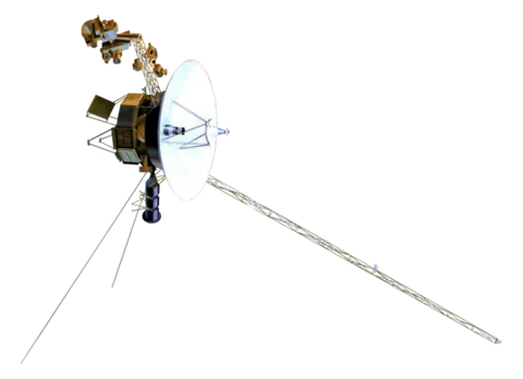
About Voyager 2
On 2026-01-01, the date the map shows, Voyager 2 was 142 AU from the Sun; sunlight takes 19.6 hours to reach it.
The map lists it as a spacecraft and shows it in the Solar System part of the map, drawn on the plane of Earth’s orbit (the ecliptic).
The only spacecraft to visit Uranus and Neptune. Crossed the heliopause in 2018 at 119 AU.
Key numbers
| Distance from the Sun | 142 AU |
|---|
Where it is
Its place in the universe, from the inside out: Solar System › Orion–Cygnus Arm (Local Arm) › Milky Way › Local Group › Virgo Supercluster › Laniakea Supercluster › Observable universe.
Zoom out to see it in context: Heliopause and Voyagers, a view about 400 AU across.
From Wikipedia
Voyager 2 is a space probe launched by NASA on August 20, 1977, as a part of the Voyager program. It was launched on a trajectory towards the gas giants and enabled further encounters with the ice giants.
Excerpt from the Wikipedia article Voyager 2, licensed CC BY-SA 4.0.
Nearby on the map
- Hale–Bopp Comet
- 2I/Borisov Interstellar object
- New Horizons Spacecraft
- Arrokoth Asteroid
- Charon Moon
- Pluto Dwarf planet