 Map of the Universe
Pavo–Indus Supercluster
Supercluster · Neighboring supercluster in the constellations Pavo, Indus and Telescopium
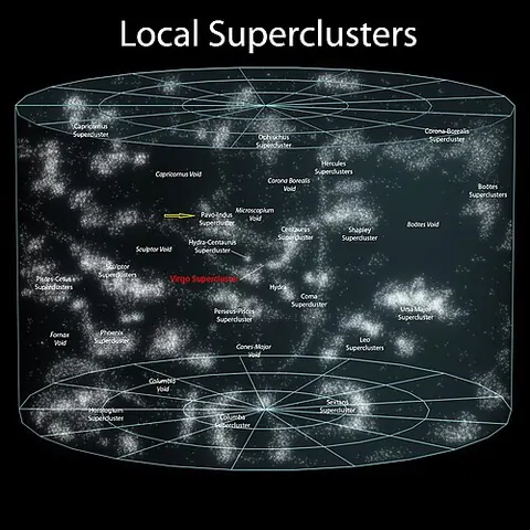
About the Pavo–Indus Supercluster
The light we see from it set out 0.21 billion years ago, when the universe was 13.6 billion years old (redshift 0.01472).
The map lists it as a supercluster and shows it at the scale of the large-scale universe, drawn on the supergalactic plane.
Its distance or nature is debated, and the map shows one published value.
Position approximate.
Key numbers
| Distance (comoving, today) | 0.212 billion light-years (65 Mpc) |
|---|---|
| Redshift z | 0.01472 |
| Light travel time | 0.21 billion years |
| Universe's age when this light left | 13.6 billion years |
| Distance method | redshift-independent (literature) |
| Supergalactic coordinates | SGL 229.9°, SGB +23.0° |
| On the map | The dashed circle marks its approximate size around its centre. Structures this large have no sharp edge, and the circle is not drawn to an exact shape. |
| Size | about 130 million light-years across |
Where it is
Its place in the universe, from the inside out: Laniakea Supercluster › Observable universe.
Zoom out to see it in context: Laniakea, a view about 850 million light-years across.
From Wikipedia
The Pavo–Indus Supercluster is a neighboring supercluster located about 60–70 Mpc (196–228 Mly) away in the constellations of Pavo, Indus, and Telescopium. The supercluster contains three main clusters, Abell 3656, Abell 3698, and Abell 3742.
Excerpt from the Wikipedia article Pavo–Indus Supercluster, licensed CC BY-SA 4.0.
Nearby on the map
- Great Attractor Large-scale structure
- Laniakea Supercluster Supercluster
- Norma Cluster Galaxy cluster
- ESO 137-001 Galaxy
- Dorado Group Galaxy group
- Local Void Cosmic void